Fire dampers containing asbestos - New VDI guideline...
VDI guideline on asbestos-containing BSK
Fire dampers containing asbestos – New VDI guideline
Posted on 18 March.
Almost all fire dampers produced up to 1988 contain components containing asbestos. Millions of these old dampers are still in use. We have already reported on this several times (see articles from April 2021 and December 2021).
The new version of the asbestos directive (November 2020) now clarifies that an individual assessment of the condition must be carried out by the builder/owner. In March 2021, the German Association for the Restoration of Hazardous Substances (GVSS) initially published “Recommendations for handling fire dampers containing asbestos”. Ms. Weiblen, Mr. Malkmus and Dr. Kisskalt from our company were involved in the drafting process.
Based on this publication, the VDI founded a committee to draw up a VDI guideline on “Asbestos-containing fire dampers” (VDI 6202 Sheet 3.1). Our colleagues were again represented here. Dr. Kisskalt took over the deputy chairmanship of the committee (Chairman: Mr. Olaf Dünger). In a very short time – for guideline committees – a draft was prepared and finished in a final reading in the committee on 28.11.2023, which is to be published shortly as a green print (probably in April 2024).

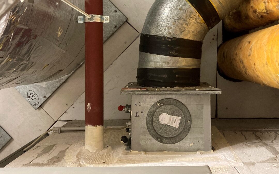
Asbestos-containing BSK with damaged stop seal

Inspection of a BSK containing asbestos
This provides all building owners with a technical basis for dealing with fire dampers containing asbestos. We will be glad to support you in this task.
Further information on “Fire damper inspection” can be found here.
LGA Institut für Umweltgeologie und Altlasten GmbH
Christian-Hessel-Str. 1
90427 Nürnberg
Tel: +49 911 12076 100
Fax: +49 911 12076 110
info@LGA-geo.de
bewerbung@LGA-geo.de
News
VDI guideline on asbestos-containing BSK
In-house seminars
In-house seminars Posted on 05 March 2024.We offer...
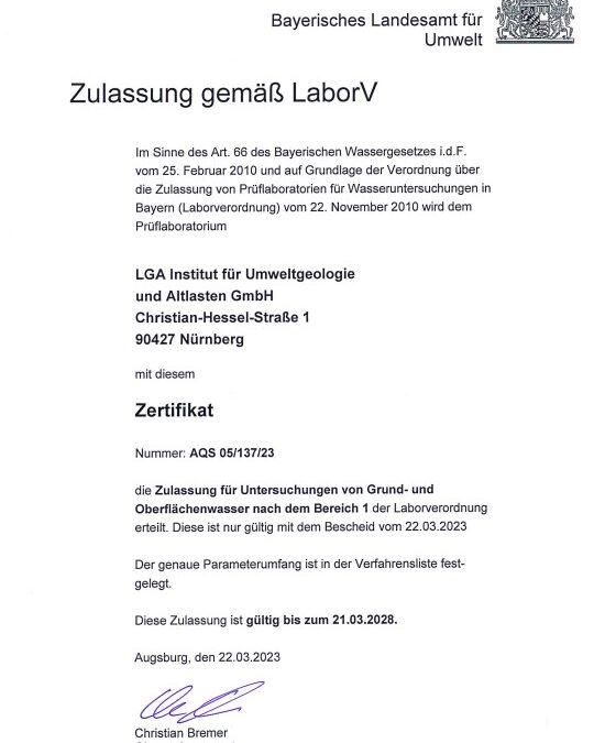
Notification according to LaborV
Notification as a testing laboratory for water analyses in...
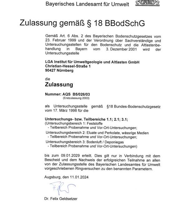
BBodSchG certification extended
Certification according to § 18 BBodSchG extended Posted...
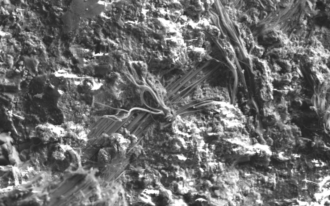
VDI Guideline 6202 Sheet3
Asbestos contamination investigation in buildings - VDI...
Older articles
